|
RISHIKESH:
| Haridwar |
|
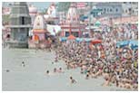 |
Haridwar is one of the most popular Hindu pilgrimage places. Haridwar is situated on the right side of the bank of the holy Ganga, and is the point where the river spreads over the northern plains.. Haridwar or ‘Gateway to Gods’ is also known by the names of Mayapuri, Kapila and Gangadwar. It is also one of the four venues for the Kumbh Mela, held in its magnitude every twelve years. The Rajaji National Park is around 10 km from Haridwar. It’s an ideal destination for wild life and adventure lovers. It has 23 species of mammals and 315 avifauna species. |
| |
 |
| |
|
| |
|
| |
|
| |
Top |
| |
|
| Rishikesh |
|
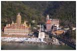 |
Rishikesh, the 'place of sages' is a celebrated spiritual town on the bank of Ganga and is surrounded by Shivalik range of the Himalayas on three sides. Rishikesh is 225 kms from Delhi. It is believed that when Raibhya Rishi did hard penances, God appeared by the name of "Hrishikesh" and this area henceforth came to be known as Rishikesh. Laxman Jhula, Ramjhula, Parmarth Niketan, Geeta Bhawan, Swarg Ashram, Shivananda Ashram Bharat Mandir, Trivani Ghatt, Kailash Niketan Temple (13 storey temple at Laxman jhula), Neel Khant temple, Kunjapuri Temple, Virbhadra Mahadev temple. Rajaji National Park. |
| |
|
 |
| |
|
| |
|
| |
|
| |
Top |
| |
|
| Mussoorie |
|
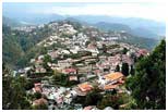 |
Mussoorie has a beautiful nature walk known as "Camel's Back Road". There is also "Gun Hill" where a cannon was used to sound out midday for many years. The oldest Christian church in the Himalayas, St Mary's, is situated above Mall Road, and is currently undergoing restoration. Kempty falls is a nice picnic spot. Company Garden is popular tourist destination. Happy Valley has a small Tibetan temple. This was the first Tibetan temple built in India. The temple was constructed in 1960 by the Tibetan refugees. Lal Tibba is another tourist spot of Mussoorie. |
| |
|
 |
| |
|
| |
|
| |
|
| |
Top |
| |
|
| Lansdowne |
|
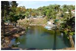 |
Lansdowne is one of the quietest hill stations of India and is popular since Britishers came to India. Lansdowne is unlike other hill stations as it is well connected with motorable roads but remote in its own way. It is situated at an altitude of 1,700mts above sea level surrounded with thick oak and blue pine forests in the Pauri Garhwal district of Uttarakhand state. Lansdowne got its name from Lord Lansdowne, who was the then Viceroy of India during the period of 1888 - 1894. Presently, Lansdowne has the command office of the Garhwal Rifles division of the Indian Army. |
| |
|
 |
| |
|
| |
|
| |
|
| |
Top |
| |
|
| Chakrata |
|
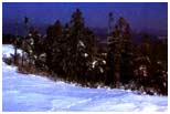 |
Chakrata is one of the hidden jewels of Garhwal region of Uttarakhand state. Situated in Dehradun district at an elevation of 2,270mts above sea level, Chakrata is a quaint little hill station and a cantonment area situated between Yamuna and Tons River. Chakrata was earlier known as Jaunsar Bawar and the region is mainly populated by Jaunsari tribes. Chakrata is an exquisite hill station situated amidst coniferous, rhododendron and oak trees. It is a charming destination situated away from the hustle bustle of the town offering tranquil environs and salubrious weather. Chakrata is blessed with natural splendors and panoramic vistas of nature. |
| |
|
 |
| |
|
| |
Top |
| |
|
| |
|
| |
|
| Nainital |
|
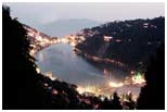 |
Nainital is 34 Km from Kathgodam, the gateway of Kumaon and the terminus of North Eastern Railway. It is 304 km from Delhi, capital of India. Dotted with lakes (Naini Lake, Bhimtal, Naukuchiatal, Khurpatal, Sattal), Nainital has earned the epithet of 'Lake District' of India'. The most prominent of the lakes is Naini lake ringed by hills.
Nainital's unending expense of scenic beauty is nothing short of a romance with awe-inspiring and pristine Mother nature. Known for its salubrious climate and scenic beauty, the town is a popular health resort and attracts tourists around the year.
|
| |
|
 |
| |
|
| |
Top |
| |
|
| |
|
| |
|
| Kausani |
|
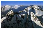 |
There are very few places in the Himalayas which can compare with the beauty of Kaushani.As the entire Kumaon Hills have been known for their idyllic beauty with the huge mountains silhouetted against the sky.Kausani was originally called Valna. Kausani offers the magic of the deep pine forests and the majestic mountains. Kausani the birthplace of the famed poet Sumitra Nandan Pant is often referred to as the 'Switzerland of India. Situated among mountains and trees, the peaks Trishul and Nanda Devi are clearly visible from here. In 1929, Mahatma Gandhi spent 12 days here and brought his thoughts out in his book called Anasakti Yoga. The place where he stayed is called the Anasakti Ashram. This Ashram was earlier the guest house in a tea estate. |
| |
|
 |
| |
|
| |
|
| |
Top |
| |
|
| |
|
| |
|
| Dhanaulti |
|
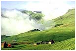 |
Dhanaulti is located amidst thick virgin forests of deodar, rhododendron and oak. Dhanaulti has an atmosphere of placidity and tranquillity. Indulge yourself in the lazy outings, long wooded slopes, cool breeze, salubrious weather and exquisiteness of Dhanaulti. Unobstructed views of the snow capped Himalayan peaks are distinctly visible from Dhanaulti, adding charm to this heavenly place. Dhanaulti is situated on Mussoorie – Chamba road at an elevation of 2286mts above sea level. Dhanaulti is a popular excursion of Mussoorie, Chamba and Kanatal and it is also an ideal weekend getaway as it is only 8-9 hrs drive away from Delhi. It gives a mystical feeling making it popular amongst coupes and adventurers. |
| |
|
 |
| |
|
| |
|
| |
Top |
| |
|
| |
|
| |
|
| Auli |
|
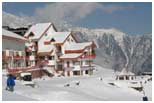 |
The distance of 16 km from Josinath on the way to Badrinath, Auli forms a section of the Garhwal mountain range. The breathtaking 9000 ft slopes above the sea level bordered with oak and deodar trees minimize the speed of the wind which helps the skiers to enjoy their joyride smoothly. It is said that the great Guru Adi Shankaracharya wandered on these grasslands in the 8th century. The temple of Joshimath in Auli still remains as a symbol of Guru. Much more is said about this place; many say before developing into a ski destination, the Indo-Tibetan Border Police Force was trained on its slopes. The transportation to reach here is well available. The nearest Airport is Dehradun which is 298 kms away and Rishikesh, the nearest railway station, is 235 kms away. |
| |
|
 |
| |
|
| |
|
| |
|
| |
|
| |
Top |
| |
|
| Shimla |
|
 |
Shimla is a tourist destination is also the capital of the Himachal state. It is situated in the north-west Himalayas. Shimla is often referred to as the "Queen of Hill Stations" (a term coined by the British). It has been blessed with all the natural bounties, one can think of. Shimla, draped in forests of pine, rhododendron, and oak, experiences pleasant summers and cold, snowy winters. The biggest industry in Shimla is hotel, travel and tourism. Bulging at its seams with unprecedented expansion, the town retains a colonial aura, with its grand old buildings. |
| |
|
 |
| |
|
| |
|
| |
|
| |
Top |
| |
|
| |
|
| Manali |
|
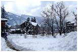 |
Manali is located at 32.16°N 77.10°E The town ranges in elevation from 1,800 m (5,900 ft) to, in the uppermost "Old Manali" section, 2,000 m (6,600 ft). The name Manali is derived from Manu-Ali i.e. 'Manu's doorway' after the Sage Manu who lived here. In ancient times, the valley was sparsely populated by nomadic hunters known as 'rakshas'. The next arrivals were the shepherds who arrived from the Kangra Valley and settled to take up agriculture. Some of the earliest inhabitants of the region are the 'naur' or 'nar', which is a caste unique to the Kullu valley. Only a few naur families are known to exist now. A naur family in the village Soyal near Haripur on the west bank of Manali was famous for the vast land they owned and their practice of having 'rakshas' as their labourers. |
| |
|
 |
| |
|
| |
|
| |
|
| |
|
| |
Top |
| |
|
| |
|
| Palampur |
|
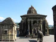 |
The town of Palampur (1219 m) is situated in a idyllic valley priding itself with tea gardens, and hills covered with pine trees. The place enjoys a year-round pleasant climate and the pine scented air is said to have curative properties. The scenery presents a sublime and beautiful contrast- the valleys presents a picture of rural innocence and repose, while the hills are majestic. Overlooking this town are the majestic Dhauladhars, whose tops remain covered with snow for most of the year. This place is thronged tourists and is now being developed as a large tourist centre.
Approach
Air: Nearest airport is at Gaggal 40 km.
Rail: Palampur is connected by Pathankot-Jogindernagar narrow gauge railway line.
Road: Palampur is also accessible by road and there are many buses from Dharamshala 40 kms, Kangra 38 kms, Kullu 205 kms & Shimla 259 kms.
|
| |
|
 |
| |
|
| |
Top |
|
|

